It is at its most spectacular in the autumn.
The road, which winds its way through an archipelago off the northwestern coast of Norway, is swept by the harsh wind and soaked by the driving rain and crashing waves that reach 15 metres into the sky, thrown up by the swollen sea.
Drivers that slowly make their way along it try to muster up their courage as their windshield wipers clear off as much as water from the rain as they do from the waves. Ahead of them lies a shiny, silvery line of a road that resembles a serpent swimming through the turbulent waters.
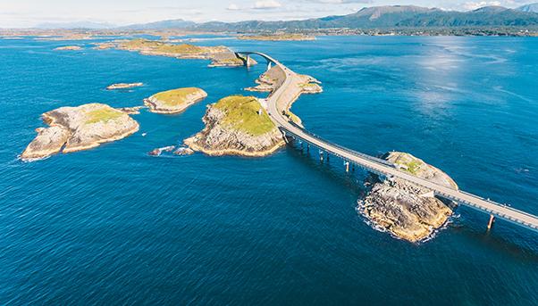
Its official name might be the Atlantic Road, but this windy stretch of 38 kilometres between the towns of Bud and Kristiansund is better known as one of the most dangerous in the world. Its most famous section runs for eight kilometres, supported by 12 bridges that stand an average of 10 metres above the strong currents that run between the islands that the road connects like a necklace.
A unique marriage of modern engineering and natural spectacle, the road boasts its status as a National Tourist Route and is promoted by Norway as an “Engineering Feat of the Century”. The British daily The Guardian, meanwhile, simply calls it one of the most spectacular drives in the world.
Early last century, the link between the two towns was supposed to be a railway. But the idea later turned into a road, the construction of which began only in 1983. Six years and 12 hurricanes later, the Atlantic Road – in fact, a section of Country Road 64 – was opened. It remained a toll road for 10 years to recover a quarter of the €14 million that took to build it. The rest of the cost was financed by the government.
Cars, trucks, motorcycles and bicycles were free to use it at 3:00 p.m. on June 26, 1999 when the toll was finally lifted.
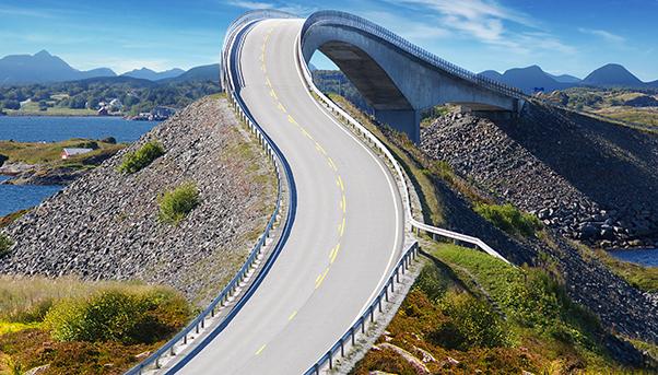
What makes the Atlantic Road special is its resemblance to a single bridge, winding its way across the islands along the coast.
One of its many bridges, Hulvagen, is actually three bridges that together reach 293 metres in length.

The most spectacular is the Storseisundet because it stands over one of the archipelago’s highest islands, obliging drivers to scale a steep curve before taking a sharp drop on the other side, like a rollercoaster. It becomes dangerous during the autumn months when the wind is strong and the storms are frequent, sending waves crashing against the structure.
The Atlantic Road is a source of fascination nevertheless. Television producers do commercials along it. Amateurs post videos online to be viewed by millions. Companies are inspired to conduct surveys, like satellite navigator maker TomTom, which found that 14,000 respondents considered it a better drive than Estoril Ocean Driver in Portugal, the road along the shore of Lake Como in Italy, the Peloponnese in Greece and the North Coast 500 in the Scottish Highlands.
In recognition of the beauty that the scenery offers, the operators of the road have set up four observation points along the road. They appear in the most unexpected places, metres above the sea, exposed to the splashes of the waves. Fishermen often join tourists on these points, casting their lines in the hope of a good catch.
One of the places that the Atlantic Road reaches is Molde, the biggest city in the area with more than 250,000 residents. It is home to the oldest jazz festival in Europe. Held in June, it attracts nearly 100,000 tourists every year. Many of them take time to drive along the road to view sceneries that can be found nowhere else on Earth.


