uring the last few months of 2018, wandering through Pittsburgh’s gardens that adorn the end of “The Point”, the peninsula where the Allegheny and Monongahela rivers converge to form the Ohio River, was not easy for anyone.
The heavy rains that fell on the city last year made it into one of the wettest on record, significantly impacting the lives of its residents and putting a strain on its water infrastructure, including dams and sewers.
In a survey published by the National Weather Service on December 3, the city received 53.3 inches (135.2 centimeters) of rain last year, four inches (10 centimetres) short of the record set in 2004. It was the latest sign that rainfall has been rising over the last three decades, according to the U.S. federal government agency in charge of weather forecasts and analysis.
From 2009 to 2018, Pittsburgh received 399 inches (1,018 centimetres) of rain, more than the 368 inches (980 centimetres) recorded two decades earlier.
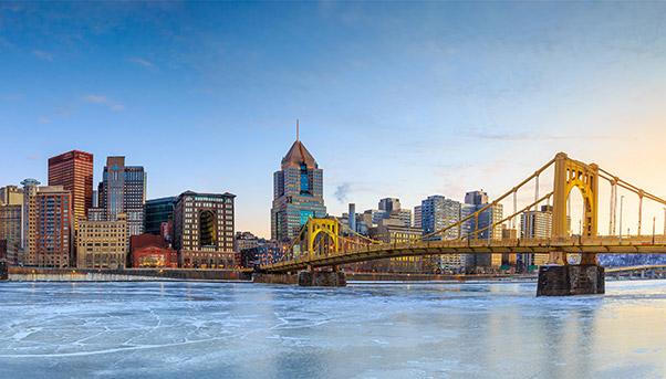
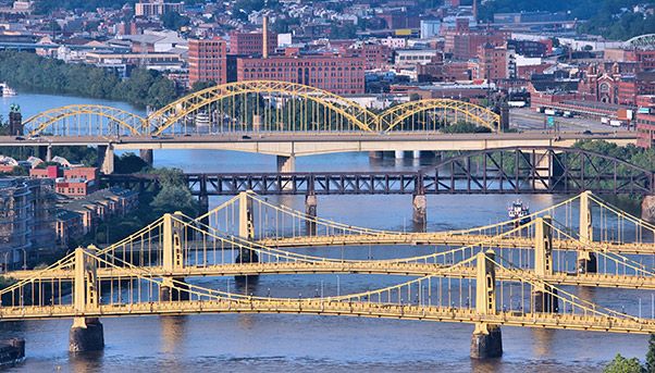
The "City of Bridges", a title the city carries for the large number of bridges over the Allegheny, Monongahela and Ohio that link downtown with the surrounding area, is considered by many to be one of the best places to live in the United States. But the violent rainfalls have been overwhelming its water infrastructure and created an urgent need to modernise it to help it cope and avoid polluting the rivers.
Investing in water infrastructure
Pittsburgh's water infrastructure is not ready to withstand the effects of climate change. According to Greg Scott, a representative of the Pittsburgh office of the American Society of Civil Engineers (ASCE), the functioning of the water supply is guaranteed only if rainfall stays within traditional levels, the local newspaper "Pittsburgh City Paper" reported. His view is confirmed by the ASCE itself, which gave the infrastructure of Pennsylvania a C- in general, but a D for water (which means management of water courses, sewage networks, dams, and similar things).
Although the Pittsburgh Water and Sewer Authority responded with an allocation of $88 million to upgrade the water supply network, the city had already been working to resolve the problem for a few years.
Since 2016, it has been developing so-called "green" infrastructure to help deal with the run-off created by heavy rainfall. The "City-Wide Green First Plan", supported by the city government and the Pittsburgh Water and Sewage Authority, calls for the creation of green areas that can manage storm water and the resulting sewage overflows. It is a large-scale plan involving 1,835 acres of urban land during the next 20 years by creating green spaces.
Although these initiatives have proven to be a good starting point, they are not enough. The city must be able to control better the large rivers that surround it. This brings into focus the strategic role played by its ageing system of locks and dams.

City view with bridges
The dams that protect Pittsburgh
One of the most significant moments in the history of the city's water infrastructure dates back to 1936, when the Great Flood put entire neighbourhoods including the Strip District and Downtown under water. That was when the city started to build a system of locks and dams to control the flow of the rivers and avoid the risk of flooding. Eighty years later, these infrastructures are still essential to protect the city. But they urgently need modernising. On November 28, the U.S. Army Corps of Engineers, which manages regional locks and dams, announced $123.7 million of investments for 2019.
«These additional funds provide a boost to the regional economy while maintaining and enhancing our vital water resource infrastructure», said Pittsburgh District Commander Col. Andrew "Coby" Short. «This will help ensure we fulfill our commitment to reduce flooding, provide reliable navigation, enhance the environment and offer quality recreation for the citizens of the Upper Ohio River Basin».


